

The South Dakota Legislature approved new boundaries on Wednesday, November 10, in a redistricting process that occurs once each decade. The map now includes new districts for Sioux Falls and removes one rural district.
In South Dakota, the state legislature is responsible for redistricting according to the South Dakota Constitution. All new districts must be voted on and then approved by the House and Senate, and then signed by the Governor.
John Mills, a member of the South Dakota House of Representatives serving District 4, said, “Our state Constitution stipulates we need one legislative district for each Senator. Since 1970, we have had 35 senators/districts, the most allowed.”
To deal with the issue of redistricting, a special session was called and legislators took three intense days to hammer out negotiations. The proposal eventually cleared the House by a handful of votes at 37-31, with the more conservative faction of Republicans offering the most opposition. It easily passed the Senate at 30-2. Governor Noem signed it into law that night.
According to members who backed the new map, the latest Census numbers indicate the state’s population has shifted towards its urban areas and redistricting is necessary to reflect that change. Lawmakers also cited federal law, which requires them to provide for the voting rights of Native American residents.
The proposals differed greatly in their approach to Native American reservations and the rural areas around Rapid City.
What criteria must be considered in redrawing district boundaries? First, South Dakota must:
- Ensure equal population. We must ensure that each legislative district roughly has the target number of people in it, which is 25,333 people.
- Comply with the Federal Voting Rights Act. This law was passed by Congress to ensure that minorities have an equal opportunity to elect representatives of their choice.
Additionally, South Dakota has criteria it uses in drawing the districts. They include: Adherence to standards of population deviance. That means states have some flexibility to draw districts with more or less people than the target number if the reason the legislature did so is somewhere on this list.
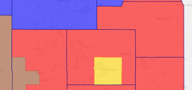
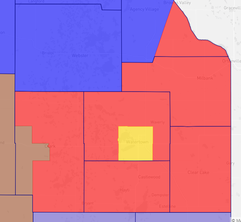
Protection of minority voting rights. South Dakota has its own requirements, outside of the Federal Voting Rights Act, to ensure minorities have equitable representation. Be contiguous. This means you can travel from one end of the district to the other without ever leaving the district.Be compact. There are many definitions of compactness. Generally, it refers to the shape and size of a district, still accounting for equal population, that tends to be more geometric and has a clear center point. Respect geographical and political boundaries. That means trying to keep counties, cities, reservations, etc., together within a district. Fred Deutsch, also a Republican member of the South Dakota House of Representatives, who represents District 4, said, ” With three long days and much gnashing of teeth, the House approved a compromise map. The final map keeps Grant County whole –Milbank remains with the rest of Grant County. Watertown remains a separate district. It is not split and is not a part of our district (District 4).
“However,” Deutsch went on to say, “there are significant changes throughout the state. In our district, Grant County, Deuel County, and the rural parts of Codington County remain unchanged. Added to our district is Hamlin County, most of Clark County including the city of Clark, and a slice of Roberts County. Sadly, our district will no longer include rural Brookings County.”Mills also referred to the lengthy and tense redistricting process, “About midway through their work, Senate members surprised their House colleagues with a map that only Senate members had previewed, that did not meet the agreed standards, and then called for a vote on it. That caused a rift, split the committee, and resulted in two maps for the legislature to consider. Last week, the House did just that, debating the merits of both maps.”Mills went on to say, “In contrast, the Senate played politics and gutted the House map, inserting their own in its place, giving them two identical maps (theirs) to consider. In fairness, the Senate’s map was really the work of one Senator who holds a powerful position. “Over two and a half days of frustration, the House did manage to make a few changes, but the end result, passed by the slimmest of margins, is mostly one Senator’s map that in my view is far less representative and not what South Dakotans said they wanted,” he added.
Mills said, “While most districts could have stayed largely unchanged, the map we ended with reshuffles almost everything. As a result, Brookings County for example will leave District 4 and be joined with Kingsbury, Lake, and most of Miner County as a new district.”
Staff


No comments so far.
Be first to leave comment below.