


The Big Stone Sheriff reports the Big Stone Lake area received up to 7.6 inches of rain yesterday June 12 and during the early morning hours of June 13. The rain is causing widespread flooding and some travel disruptions. Sheriff Mark Brown cautions that boats on lifts are likely to float and need to be secured as soon as possible as the lake could rise one to two feet or more in the next 72 hours.
Artie’s Bait Shop reports residents of Meadowbrook East – about seven miles north of Ortonville — were not able to leave their properties as flood waters from Meadowbrook Creek overflowed onto the road and blocked their only exit. State Hwy. 7 was also blocked in that area. Artie’s also reports that large logs have been reported on Big Stone Lake.
The Big Stone Sheriff’s statement reported the recorded lake level was 966.95 feet at 8 a.m. this morning, which reflected a rise of 0.30 feet (3 tenths) since yesterday’s reading of 966.65 feet. (Please note: this elevation should be interpreted with caution. Inflow into the lake and wind conditions can significantly impact water levels at various points along the shoreline.) Sheriff Brown strongly encourages all lake shore property owners to monitor conditions closely over the next several days.
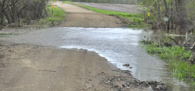
Sheriff Brown also urges motorists to use extreme caution, “Several roads are currently experiencing water over the roadway, and some have sustained damage from the water flow. Drivers are urged to reduce speed, remain alert and never attempt to drive through flowing water.” He cautions that some roads could remain impassable for several days. He recommends motorists traveling at night take extra precautions as water and road damage could be difficult to see.
Water Over Roadways
Please drive with care. The Big Stone County Sheriff’s Office is aware of water over the roadways in several areas. These areas include:
– Hwy 75 & CR 12
– Hwy 7 & 770th Ave
– Hwy 7 & 390th St
– Hwy 7 & Golf Course Road
– CR 25 & 360th
This list is not all-inclusive, and it is likely to change. More rainfall is expected.
Twelve inches of moving water can carry away a car. Turn around, don’t drown!
Conditions in Roberts County have also prompted a flood warning. As of 5 a.m. today, June 13, the National Weather Service has placed Roberts County, including the Sisseton and Peever areas, under a flood warning due to over 5 inches of fast-falling rain overnight.
The Roberts County Sheriff’s Office stated, ”Widespread flooding has been reported throughout the county, including along I-29 near mile marker 221. Numerous roads are impassable, and many others may appear safe, but have unknown structural integrity due to rapidly moving water.”
The South Dakota Highway Patrol also reported dense fog this morning in the northeast part of the state, including Roberts County. According to SDHP, crews have been working to mark roadways with water running over them. They caution motorists to turn on headlights, slow down, and buckle up.
Grant County Sheriff Kevin Owen reports that Grant County has experienced some minor lowland water pooling.
Conditions and reports are continuously changing. Verify before you go.
Staff


No comments so far.
Be first to leave comment below.